England Maps
RRP:£7.95
In stock
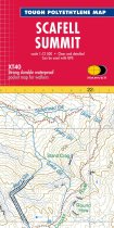
Helps you decipher the detail Enlarged map for hillwalkers of the summit of Scafell at...
Please log in to see your price
Stock No:
13585
RRP:£11.50
Currently out of Stock
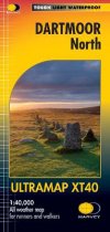
The Ultramap covers a large area yet is small enough to slip in a pocket.It is a fully...
Please log in to see your price
Stock No:
58057
RRP:£11.50
Currently out of Stock
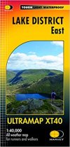
The Ultramap covers a large area yet is small enough to slip in a pocket.It is a fully...
Please log in to see your price
Stock No:
58058
RRP:£11.50
In stock
HARVEY launch innovative new series: Ultramap XT40. 16 titles featuring in Trail...
Please log in to see your price
Stock No:
53449
RRP:£11.50
In stock
HARVEY launch innovative new series: Ultramap XT40. The Ultramap covers a large area...
Please log in to see your price
Stock No:
53375
RRP:£11.50
In stock
Covers a large area yet is handily compact. Pocket perfect! Detailed map for runners...
Please log in to see your price
Stock No:
11614
RRP:£11.50
In stock
HARVEY launch innovative new series: Ultramap XT40. 16 titles featuring in Trail...
Please log in to see your price
Stock No:
12892
RRP:£3.99
Currently out of Stock
Navigate your way around York with detailed street maps from A-Z
This up-to-date,...
Please log in to see your price
Stock No:
11780
RRP:£7.95
In stock
This map provides a colourful overview of the Dales - famous Swaledale, Wensleydale,...
Please log in to see your price
Stock No:
53445
RRP:£3.99
In stock
Handy little full colour map of Yorkshire Dales National Park. Detailed mapping and...
Please log in to see your price
Stock No:
58336
RRP:£6.99
In stock
Walking guide to the Yorkshire Dales National Park, with 20 best routes chosen by the...
Please log in to see your price
Stock No:
58327
RRP:£6.95
In stock
Yorskhire Dales 8 walks centred on Hawes. The map is clear and easy to understand. It...
Please log in to see your price
Stock No:
53432


