Maps & Atlases
RRP:£11.50
In stock
The Ultramap covers a large area yet is small enough to slip in a pocket.It is a fully...
Please log in to see your price
Stock No:
58056
RRP:£11.50
In stock
The Ultramap covers a large area yet is small enough to slip in a pocket.It is a fully...
Please log in to see your price
Stock No:
56413
RRP:£11.50
Currently out of Stock
Covering a large area, yet compact enough to fit in your pocket, the XT40 Ultra Map has...
Please log in to see your price
Stock No:
51301
RRP:£11.50
In stock
Covers a large area yet is handily compact. Pocket perfect!
Detailed map for runners...
Please log in to see your price
Stock No:
12351
RRP:£11.50
In stock
HARVEY launch innovative new series: Ultramap XT40. The Ultramap covers a large area...
Please log in to see your price
Stock No:
12666
RRP:£11.50
In stock
Covers a large area yet is handily compact. Pocket perfect!
Detailed map for runners...
Please log in to see your price
Stock No:
12306
RRP:£11.50
In stock
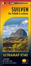
Detailed map for runners and walkers of Suilven and the surrounding area at the magic...
Please log in to see your price
Stock No:
59734
RRP:£11.50
Currently out of Stock
Covers a large area yet is handily compact. Pocket perfect!Includes Slioch, Beinn...
Please log in to see your price
Stock No:
49928
RRP:£11.50
Currently out of Stock
Covers a large area yet is handy and pocket perfect. 22 Munros, 14 Corbetts and 5...
Please log in to see your price
Stock No:
56412
RRP:£14.95
In stock
The idea for the Yellow Map Atlas arose from a frustration with GPS devices that have...
Please log in to see your price
Stock No:
71154
In stock
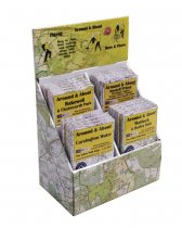
Counter display unit with 4 pockets for the A&A and H&T maps. Holds a total of 20 maps.
Please log in to see your price
Stock No:
71137
Currently out of Stock
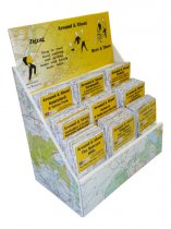
Counter display unit for A&A and H&T Yellow maps. 9 pockets, holds a total of 45 maps.
Please log in to see your price
Stock No:
71138


