Maps & Atlases
RRP:£6.99
In stock
Short Walks Made Easy Guide to the Lake District, featuring 10 outstanding walks...
Please log in to see your price
Stock No:
58780
RRP:£6.99
In stock
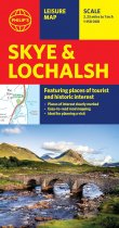
Brand new edition from Philip's of this information-packed sheet map of Skye and...
Please log in to see your price
Stock No:
12623
RRP:£5.99
In stock
A detailed easy to use colour map with unique 3-D shaded relief. Scale 1 : 170,000
Please log in to see your price
Stock No:
37728
RRP:£6.95
In stock
An encapsulated detailed easy to use colour map with unique 3-D shaded relief. Scale 1...
Please log in to see your price
Stock No:
56267
RRP:£3.99
Currently out of Stock
This handy full-colour map of Skye shows the road network of the island, ferry ports,...
Please log in to see your price
Stock No:
51402
RRP:£4.95
In stock
This detailed and easy to use map and guide cover Snowdon and the Gylders, as well as...
Please log in to see your price
Stock No:
54456
RRP:£3.99
In stock
Handy little full colour map of Snowdonia National Park. Detailed mapping and visitor...
Please log in to see your price
Stock No:
58334
RRP:£9.99
In stock
A deadly gift
Imogen Clark wakes up on her 16th birthday to find her parents dead at...
Please log in to see your price
Stock No:
10311
RRP:£9.99
In stock
Two Deaths. Two Rivals. One Unforgiveable Betrayal.
When the turf war between the...
Please log in to see your price
Stock No:
10312
RRP:£16.99
Currently out of Stock
The only county atlas with all the named streets of Somerset - more than 24,000 named...
Please log in to see your price
Stock No:
59586
RRP:£3.99
Currently out of Stock
Explore new places with handy pocket maps from Collins.
Handy little full-colour map...
Please log in to see your price
Stock No:
60353
RRP:£14.95
Currently out of Stock
The 162-kilometre South Downs Way begins in Winchester and traces a ridgeline along the...
Please log in to see your price
Stock No:
57838


